Bezvodovka is a solar observatory. It is an ancient Bronze Age architectural monument of land architecture, science and spirituality spanning nearly 20 square kilometres. The research in this blog post is unique and exploratory because it contradicts the accepted interpretation of the site. Current mainstream interpretations of these are burial mounds of nomadic tribes. Scholars have long studied the mounds at Bezvodovka and seem to feel they have them easily defined. New research, however, suggests that this site could be far more intriguing and amazing than the mainstream interpretation.
In the Chernihiv region of Ukraine, near the city of Ichnia, at Bezvodovka plateau, there are a group of ancient mounds. Some of them were destroyed by people and machinery while the others that remain have been described by scholars as mounds of nomadic tribes from the 1st and 2nd centuries BCE. However, new knowledge has allowed us to unite the scattered mounds into a single complex of nearly 20 square kilometres. Aerial photography records and computer applications have made it possible to also determine the purpose of the mounds.

North-eastern and southern neighbours viziers Roblenytsi burial complex.
If one stands in the centre of the mound complex, they may see the sun rise and set behind the manually-produced hills on the winter and summer solstice and the equinox. The most important holidays of the year fall on these very days. Bezvodovka appears to be an ancient solar observatory like the English Stonehenge or German Goseck.
At Bezvodovka, the movements of the sun and other celestial bodies are marked on the horizon, making it easy to track the regularities of their movement over time. Bezvodovka is an instrument of incredible scale, the components of which are land, sky and cosmic objects. The dimensions of Bezvodovka observatory and distances between its principal sites, which range from 800 to 4000m, imply a high precision rate for the points of the sun emerging on the horizon.
The solar observatory should be considered not only as an interesting archaeological monument but also as evidence of civilisation in Ukraine thousands of years ago. These people organised and constructed the means to research space and the stars. Bezvodovka has concealed its secrets for a long time, but now, through modern means, it reveals the knowledge of ancient astronomers.
Bezvodovka Solar Observatory
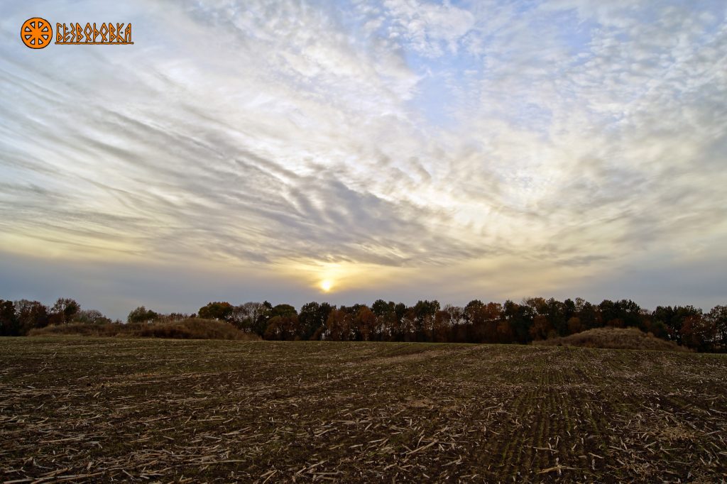
Sunset on Bezvodovtsi.
On the three-verst map made by Fedor Schubert made in 1861, there are 6 mounds depicted in a circular position. Four of them have an elongated shape. It enables one to imagine how the complex may have looked 150 years ago. Four large mounds and one satellite mound have survived today; the others destroyed through human indifference.
-

- Example of Fedor Schubert’s Topographic map showing the location of the Bezvodovka solar mounds.
-
- Comparison to the same location today
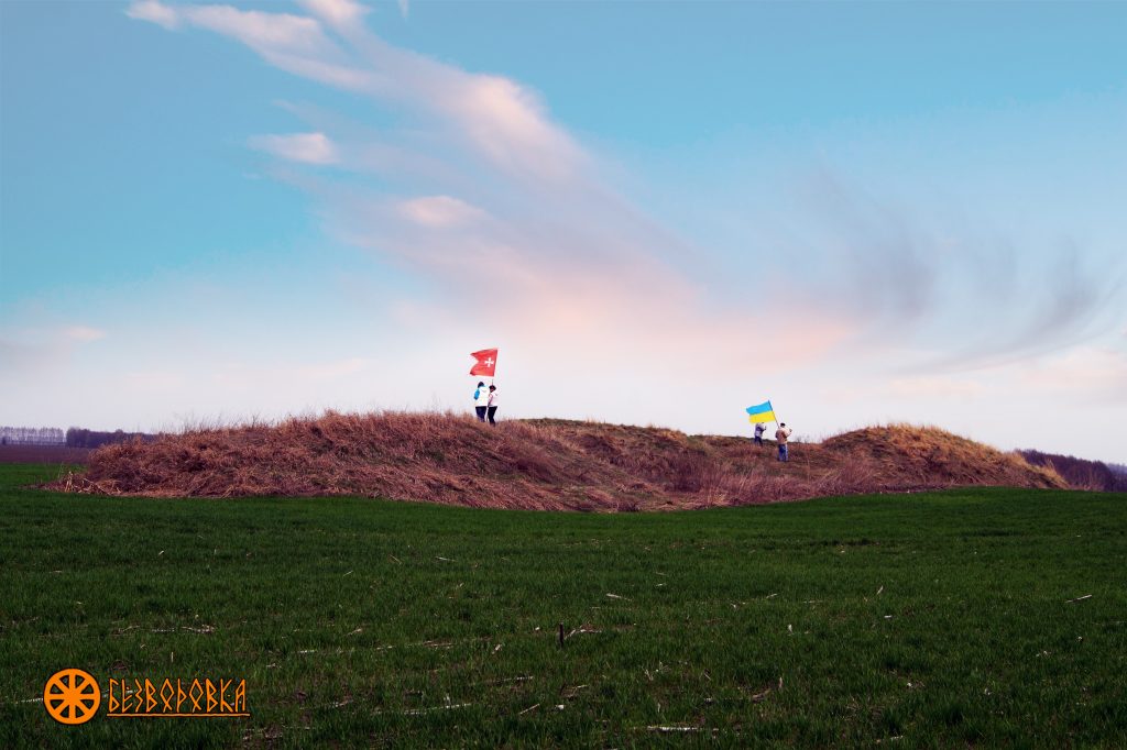
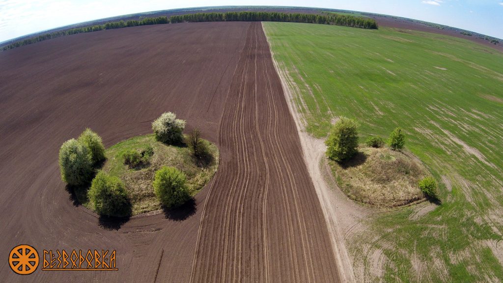
The remaining mounds allow us to presume that there were eight of them and they served as a site for astronomic observations. In the satellite photo, near the surviving mounds, one may see dark crosses at the place of the ploughed mounds. Six sites mark astronomic events such as sunrise and set in days of the winter and summer solstice and the autumn and spring equinox. It is unknown what the southern site points to. These sites may also have been used to observe the moon.
Southwest distant viziers
It could be suggested that the observatory was built around the same time as the famous solar observatories of Arkaim and Stonehenge, three to five thousand years ago. This conclusion can be drawn for the following reasons:
- Arkaim is located at Latitude 52039′ North, and the Stonehenge is located at Latitude 51011′ North, Bezvodovka is located at Latitude 50031′ North. The three observatories, at the distance of nearly two thousand kilometres between one another, are located within a single belt where the real shape of the Earth (non-ideal sphere) intercrosses with the imaginable correct shape.
- The diameter of the central circle at Arkaim is 150 m, the one of Stonehenge is 100 m, and the one at Bezvodovka is 185 m. The three observatories have a Northern-eastern view of the sunrise on June 22 – the longest day in a year.
Holy Geometry
While the geometry of the Bezvodovka solar observatory is determined by the terrain of the area, its mathematical proportions perfectly fit the landscape. The horizon observatory of Bezvodovka is not a random group of land mounds but a planned complex. The physical evidence of this is the proportions laid by the architects into the observatory’s structure.
The proportion is quite simple. However, the mathematics of Bezvodovka are not limited to said proportions. I cannot express how amazed I was, in comparing the distances between the centre and the distant sites, when I discovered the ‘golden number‘ F or “golden proportion”.
Euclid was the first to describe the golden proportion in 300 BCE. However, this proportion, or ‘harmonic distribution’, as it is also called, was used by the ancient Egyptians in their architecture. The proportion is divine because nature is based on it: seeds in a sunflower’s heart, the mollusc’s shell, DNA spiral’s curve, the human body, spirals of the cyclones and distant galaxies are all arranged using the ‘golden proportion’ or ‘golden” number’. Within nature, one may also find a ‘golden angle‘ which is equal to 137,50. An interesting and, probably, nonrandom coincidence is that the angle between the azimuth of the rise of the sun on June 22, the day of summer solstice (490 ) and the azimuth of its setting on September 22, the day of autumn equinox (271,50 ) is also a ‘golden angle’ with the value of 137,50.
Northeast near Roblenyts sight.
If one placed a Fibonacci ‘golden spiral’ over the observatory so that its beginning comes from the centre, the spiral will proceed through a few close sites and then some distant ones. Now it is clear why the distance between the centre the western distant site is specifically 830m rather than 700 or 1000m. The Fibonacci spiral also explains the distance of 2960m to some distant sites. Consequently, the entire structure of the Bezvodovka horizon observatory is transfused with the “golden number”.
Now a most interesting question – who required such knowledge and for what purpose?
Divine Geometry II
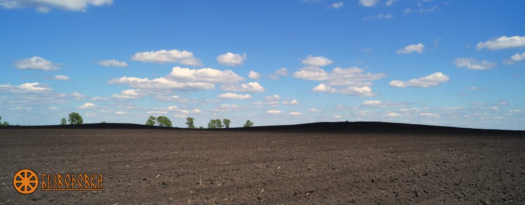
The close sites called ‘Robleni Mohyly’ (“Made Graves”) form a circle with the diameter of 185m. Furthermore, the four distant sites create a circle with a radius of 2960m. In order to make a circle of such scale, one should know the geometry of the circle and its basic component – 3,14. The distance from the centre to the Northern distant site (1830 m) and the distance between the southern-eastern and southern-western distant sites (5746 m), is equal to 3.14. This indicates that the radius of the circle is 1830 m.
Length of the circle L = 2 π r = 2*3.14*1830 = 11492 m.
Length of the circle L is to the line between SE and SW sites as 11492 : 5746, namely 2:1.
Area of the triangle (sides 4540; 5746; 4770) S∆ = 10,51 sq km.
Area of the circle (radius 1830 m) Sо = πr2 = 3,14 * 18302 = 10,51 sq km.
As one may see from the calculations, all values are not accidental and they are related. If one of them is changed, this connection will be lost.
Here comes the most interesting part! There are no indications of this fact in the available research. Therefore, I will be the first to state it and reveal a secret of thousands of years.
Mounds Ostrytsi. Southern distant viziers.
Bezvodovka observatory is located at Latitude 50о51′, that is the same angle of inclination of the Great Pyramid. However, why does the pyramid indicate this very latitude? The circumference of our planet at Latitude 50°51 is equal to 24768 km. The relation of the length of the equator to the circumference of the planet, which is indicated by the Great Pyramid, is 40075km / 24768 km = 1,618
This is a golden proportion underlying the architecture of the Pyramid of Cheops and Bezvodovka. At this very latitude five horizon observatories known today are located:
- Avebury 51°25” North
- Stonehenge 51°10” North
- Goseck 51°12” North
- Bezvodovka 50°51” North
- Arkaim 52°38” North
Therefore, the ancient engineers and astronomers possessed a system of knowledge in the domain of mathematics, geodesy, astronomy, and philosophy, which enabled them to create a measuring device of enormous dimensions such as the Bezvodovka solar observatory. Current mainstream interpretations of this site suggest these are the mere mounds of nomadic tribes. However, the solar observatory and the geometry of Bezvodovka imply it is an incredible technological achievement whose significance needs to be recognised.
Source: www.bezvodovka.com